http://www.barca.fsn...ecian-ships.htm
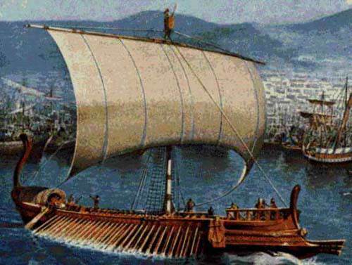
 Phoenician War Ship
http://phoenicia.org/brazil.html
Phoenician War Ship
http://phoenicia.org/brazil.html
 (excerpts)
A study researched, translated and presented by kind courtesy of
(excerpts)
A study researched, translated and presented by kind courtesy of
Mr. Christian da C. Karam, Student of Archaeology, Porto Alegre, Brazil
Phoenician Colonization
The Phoenicians inhabited the Mediterranean coasts, the narrow and fertile strip located between the sea and the mountains of Lebanon and Anti- Lebanon. Their small territory, the presence of powerful neighbours and the existence of much cedar wood (quite good for naval construction) in the mountain forests may have been the additional elements that guided the Phoenician civilization towards the exploration of the seas.
They built numerous and powerful fleets. They also visited the north African coasts and all the European south, traded in Italy, entered the Black Sea and left the Mediterranean Sea by crossing the Pillars of Hercules (today's Strait of Gibraltar and previously called the Pillars of Melqart) reaching the Atlantic ocean's African coast, and finally arrived at the Tin Islands in England. Always trading, the Phoenicians built marts and warehouses along their routes. When they could, they stole a little but always trying not to provoke powerful enemies who they preferred to weaken with gold products, instead of doing it by the sword or by fighting. The Phoenician agents and diplomats were familiar with almost every war fought at that time and they used to take advantage of it. They navigated the African continental coast in order to follow the opposite way that would be traced by Vasco da Gama much later. And more evidence seems to confirm that the Phoenicians used to cross the Atlantic Ocean to visit the "New Continent". The Phoenicians navigated by using the technique of stars orientation, the sea flows and through the winds courses. So, by following those factors their captains covered huge distances with precision. They were already influential about the year 2000 BC but their power grew with Abibaal's (in 1020 BC) and Hiram's leadership. Byblos, Sidon and Tyre were successive capitals of a state- city trading empire, united before anything else by ties of interest, habits and religion instead of a more rigid political structure.
Phoenicians in Brazil
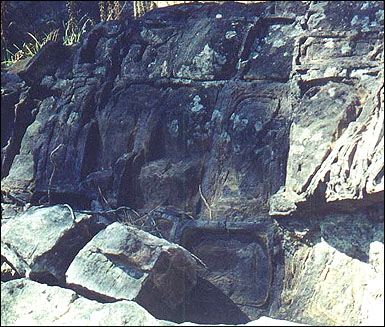
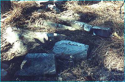
Brazil is full of vestiges that corroborate the Phoenician presence in its lands and everything indicates that they concentrated their occupation in the northeastern region. A little away from the Longá and Parnaiba rivers' confluence, in Piaui state, there is a lake where Phoenician shipyards and a harbour with a place reserved to tie the "Carpássios" (old long traveling ships) were discovered.
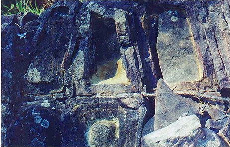
By navigating the Mearim river up north, in Maranhão state, when arriving in the Pindaré and Grajaú rivers' confluence we can find the Pensiva lake before known as Maracu. In that lake's borders there can be found shipyards made of petrified wood containing thick nails and bronze dowels. Researcher Raimundo Lopes, born in Maranhão State, excavated that location at the end of the twenties and discovered typically Phoenician tools.
In Rio Grande do Norte state, after roaming a 11 km canal, the Phoenician boats used to anchor in the Extremoz lake. The Austrian professor Mr. Ludwig Schwennhagen studied the place's subterranean parts and the embankments carefully and also some others that exist near the village of Touro where the Phoenician navigators anchored after roaming about 10 km of a canal.
The same professor Schwennhagen tells us that he found Phoenician inscriptions in the Amazon in which there were references to many kings of Sidon and Tyre (887 to 856 BC).
Schwennhagen believes that the Phoenicians used Brazil as a base during 800 years at least, leaving here, besides material evidences, an important linguistic influence among the natives.
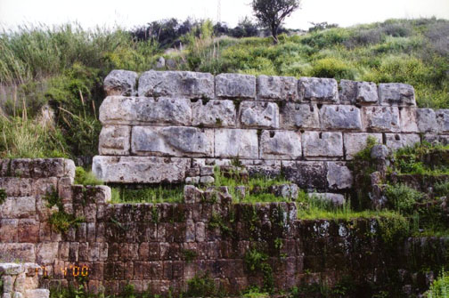
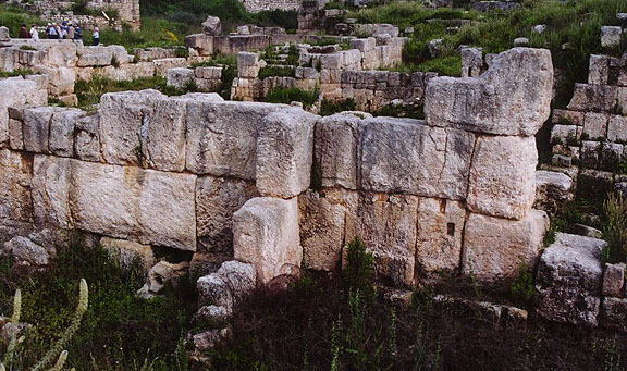
In the rivers Camocim (Ceará State), Parnaiba (Piaui State) and Mearim (Maranhão state) entrance accesses there are stone and lime walls built by the ancient Phoenicians.
Apollinaire Frot, a French researcher, traveled all over the Brazilian countryside in order to collect Phoenician inscriptions in the Minas Gerais, Goiás, Mato Grosso and Bahia sierras. The inscriptions that he put together are so many that "they would fill uncountable volumes if they were ever published", according to Frot's statements.
The translation of those inscriptions refers to Phoenician works in Brazil, to their trade activity practiced in those distant lands and to the sinking of Atlantis. Some inscriptions reveal that because of the geological shocks that hit Atlantis, its survivors went to the north of Africa to found the empire of Egypt and many other nations of the region known today as the "Middle East". Those inscriptions still mention the biblical flood that, according to them, was not a universal catastrophe but only a local cataclysm in the Mesopotarmia region. This is a fact that scientists accept as veridical nowadays.
The economic leadership condition, on whose trade others depended, gave Phoenicia a kind of stability that allowed its existence to last so long without having strong armed forces. Phoenicia survived the Egyptian, the Syrian and the Assyrian hegemonies and even the Persian domination. Finally a strange racial element appeared the invaders from Europe. Thus Phoenicia trembled, at first under the Greek invasion headed by Alexander the Great and later under the power of the Roman legions.
With such a war the trading practices were interrupted and the far away colonies and marts now abandoned, started to be destroyed by local populations. The inhabitants of those regions, too far from the metropolis, withdrew into a primitive status. Although these are just theories, it would explain the blond hair and the diverse physical constitutions of savages that can be found among some Brazilian Indian tribes in the Amazon. It would also explain the light skin and the big number of Phoenician expressions and words used by the Tiriós Indians.
Carthage, the largest of the Phoenician colonies, survived and prospered when it inherited the sea trade from its ancient colonizing cities.
It is Herodotus, the famous Greek historian, who tells us that "the Carthaginian senate published a decree in order to forbid -under penalty of death -- to organize or to take trips to the other side of the Atlantic ocean because the frequent coming of men and resources were emptying the capital".
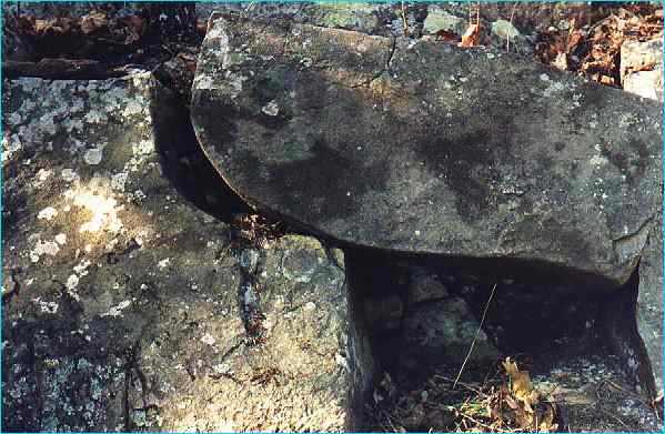
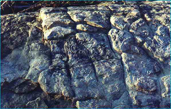
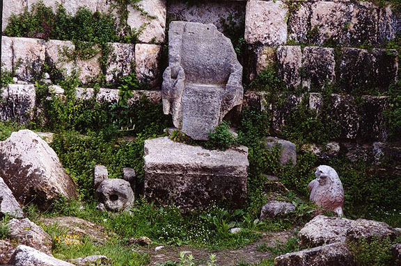
Finally there is the famous inscription in the "Pedra da Gávea" (Gavea's Rock) in Rio de Janeiro which states: "Here Badezir, King of Tyre, Jetbaal's oldest son".
There is no scientific or cultural work in Brazil that has affirmative data about the Phoenician coming to its territory. However, there are in some foreign material references to the Phoenecian navigators in Brazilian lands before its European discovery. Although that information may seem unreal, legendary and fictitious, I want to believe that it is really true.
Phoenician inscriptions found in Tyre, known today as Sur (its name in Arabic), are on tombstones, which are now in London. They mention an expedition of a Phoenician navigator to a region beyond the Strait of Moloch (today's Gibraltar) where "the sea penetrated into the land..." a place where there was an abundance of food and lots of wood.
There still is another --fact: in excavations that took place in Sidon, French archaeologists found in 1860 many wooden artifacts that only could have been taken from Brazil, according to archaeological tests. It is the famous "quebracho" or "quebra machado" (the "ax breaker") as it its known in the Brazilian countryside. Besides that kind of wood a red coloured one was found whose denomination today in Arabic remains the same as the one in Phoenician times: "Shajarat Ahmar" -- known in Portuguese as Pau- Brasil.
By the way, what is the origin of the name, which is given to the Amazon River after its source?
The answer to that question is in the Louvre Museum archives, in the Royal Museum of London and also in Vatican and Lisbon historic documents that state the Solimões River's name came from its primitive denomination, which might be "Sulaiman". So, it would be in honour of the great King of Israel -- Sulaiman (Salomon) -- given by his vassals who arrived in those regions guided by the Phoenicians, a few years before the Christian Era.
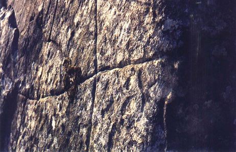
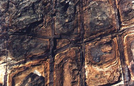
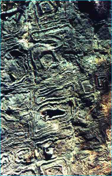
All the cuneiform inscriptions discovered in the Amazon region, in the Ararí area, as well as in French Guyana and Surinam such as hieroglyphs and rock characters demonstrate clearly its origin from Aramaic, Syriac and even Sanskrit scripts.
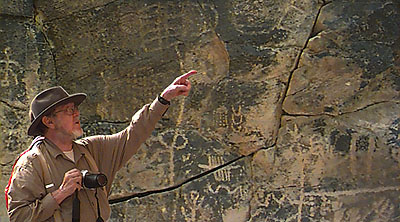
In the National Historic Museum many photographs show us huge inscriptions that are widely spread from the Solimões River up to the point where its name changes to Amazon River (from Ararí to Madeira River). Those inscriptions demonstrate just a little of the greatness of the others that exist all over Brazil.
Someone has already tried to show in Rio de Janeiro that the Maya people might have written the Gavea's Rock inscriptions. Nevertheless they are hieroglyphic inscriptions mixed with the Phoenician alphabet and originally engraved by Phoenician navigators. Other evidences are four Phoenician characters (signs) engraved on the peak of a big rock known as "Pão de Açúcar" (The Sugar Loaf).
There are various confirmations that say Brazil was already known by many sailors from the Near East even before its discovery by the Portuguese. The first European navigator to be familiar with this land was the Roman Severus Pompeus, whose documents related to that fact is in the Vatican archives. He obtained from a "Syrian" slave a report and a confirmation of the existence of others lands. What is ignored is why that navigator did not try to verify those stories by himself.
The Phoenician explorers were not interested in lands. They were really interested in its native products. So, they were not a colonizing people but a trading one.
Columbus, the great navigator from Genoa, had never been to the lands of which he used to talk so much. However, he had an itinerary, a map and other real documents concerning those distant lands. How did he get them? Some ancient historians tell the following tale about that: "One day, at his house, without anything to do, Columbus realized that in his residential area there was something buried in the ground. So, he started digging quickly and he found a rotten wooden box. Inside it there was many human bones (even a skull) and among those bones Columbus found some papyri documents. Because he already had some nautical knowledge- he was quite a good sailor- he became intrigued with the discovery and went to look for information with an uncle of his whom belonged to a religious institution and who also was a very respected person in the Spanish Royalty. Columbus gave his uncle what he had found, and he took them to one of his colleagues. Then both of them verified that those papers were descriptive maps made by a sailor from Tripoli (Trabulus) which had been buried many centuries before the fifteenth century when the place where Columbus' house was had been the sea's border.
Afterwards, Columbus got an opinion from a very important cartographer about those exceptional findings. He declared that region as being a huge territory located beyond the Pillars of Hercules (Strait of Gibraltar). He also said that its wealth was so great and there were such valuable treasures kept in that place that he who could dominate it would be considered "the Lord of the World".
Then from that day on and protected by his uncle, Columbus started to visit the Portuguese and the Spanish courts in order to obtain concession, financing and support to be the "Lord of the World".
It is said that such a report is a legend but I believe it is true: Columbus came and discovered the American continent.
In the "sambaquís" spread throughout Brazil many objects and rock inscriptions have been found. Some writers, based on paleontology material, have been writing that its origin is Indian. Other paleontologists who searched and penetrated into thousands of caves, grottos and lime cesspools declared that it its neither possible to define the exact geological erosion of the Brazilian lands nor to determine an ancient settlement in Brazil before its European discovery.
Nevertheless the Maya, the Toltec and the Aztec civilizations predominated all over the American continent. Those populations did not spring from the ground and only two other peoples could be their ancestors: the Phoenicians or the Chinese. From the Phoenicians, because they dominated the western seas and from the Chinese because they dominated the Far East seas. However, those basis are uncertain and imperfect just because until today historians were not able to elucidate such a vulnerable fact about the American pre-civilization History.
When Baron von Humboldt, at the end of the eighteenth century, took research trips to explore the Brazilian countryside, he reached the Orenoco slopes and was surprised by the greatness that Maya, Inca and Aztec civilizations offered to anyone's eyes and mind. He verified that the legends about the existence of the Amazon women- whose name was given to the river- were true.
Beuchat cites the important Inca influence in the South American civilization as well as the Aztec influence in Mexico and in Central American societies.
We can still hear about the lost cities in the Brazilian countryside region, the petrified cities such as the one known as "Sete Cidades" (Seven Cities) in the state of Piaui and others in wild zones like the states of Mato Grosso, Goiás and Amazonas.
From São Luis dos Cáceres up to the north in the state of Mato Grosso, there are places that show the existence of buried cities that are the remains of a millenarian civilization very well.
Doctor Peter W. Lund, a great Danish scholar, came up with the theory of a precivilization in Brazil and the Phoenician contribution in its formation.
The Brazilian Indians, known as Carajás and Carajá-ís, have on their names the etymology of the words whose Phoenician origin can be found in today's Arabic language. Some other Brazilian Indian tribes such as the Guaranis, the Tupis, the Guajajaras, the Chambicás, the Anajás, the Carijós, etc., have in their vocabulary thousands of Arabian words whose origin is Phoenician.
Maya and Aztec civilizations differ little from the Phoenicians. Their merchants, governors, administration, clans and their moral education clearly show us the ethnology of their civil way of life.
The Indians who deal with oil, in the north of Brazil, and who still today execute the Marajoaras work perfectly, adopt the same systems used by the Phoenician workers with oil who mixed wood and vine ashes with mud (clay) in order to produce ceramics. The resemblance among these drawings, the pots' shapes, the small statues and other Indian works and the Phoenician artifacts is noteworthy.
The same Phoenician burial ritual -- the one that buried the dead with all the objects that belonged to them -- also was adopted by almost all Brazilian Indian tribes.
The Phoenicians had a factory or a mart in a region, legendarily known as Atlantis that in their language meant -- according to the Phoenician term "Al- Atlantic"--: huge, large, extensive, vast, endless. And in Arabic "Al- Atlantic" means giant, majestic.
When I went on some trips into the Brazilian countryside, I saw some coins that had been found in Brazilian ground whose origin is completely unknown. Making a comparison among these coins and Paraguayan, Bolivian and Peruvian coins their resemblance to coins from Sidon and Tyre is very great.
In the Rio de Janeiro National Museum there exist tombstones with Phoenician, Syriac and Sanskrit inscriptions found in the Brazilian countryside.
Edmund Bleibel, a distinguished Lebanese historian, in his books "General History of Lebanon", published in Beirut, states: "when the Phoenicians were established in Africa, and Gibraltar was the limit of their empire, they planned to cross the huge ocean towards the unknown".
Then Ilu of Jbail (Byblos) and his wife Harmonia (Harmony) prepared a big fleet and navigated the enormous sea looking for the "Eternal Islands" (Canary Islands) but they disappeared forever. It was said that their souls embodied two serpents, which meant that their lives had been renewed by god, Baal's will.
Later it was corroborated that they had crossed the huge ocean and discovered the region where today is South America. So, that happened 3,000 years before Christopher Columbus.
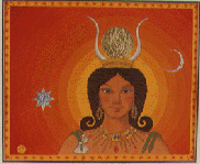
They gave the first new land they discovered the name of "Barr Ilu" which means "The Continent of God". When the nation was formed and its administration was organized, the chosen queen to rule that place was Mirinieh Mirubieh known as "Queen of the Amazones" which means "Queen of the Warriors". That queen was sent to Lebanon to save Ilu of Jbail (Byblos) who was in a critical situation.
The "Queen of the Amazons" called "The Big Ocean" the ocean known before as 'Mirubi Ocean" which today is the Atlantic Ocean. This last denomination was in honour of Atlas, the great Phoenician king of Lybia
Cadmus, the great navigator of Tyre, left his city -- Cadamiat -- on a scientific mission in order to study the Cuchite language spoken in Brazil.
A few historians have been investigating the origin of such a language and they found many evidences that confirm the Phoenician's coming to Brazil bringing with them some Greek workers before any other people. The historian Deodoro told the way they might have arrived here. That fact was confirmed by Plutarch and was mentioned by the great Brazilian historian Rui Barbosa, as well as by other Brazilian poets who sang on their lyres the Phoenician and their monuments on the Brazilian soil.
Each fleet that left Sidon, Jbail and Tyre had 200 or 300 boats that headed to Brazil. The smallest one was used to bring the members of the crew with their support material and equipment. They usually stopped to rest and also to buy supplies in Tunis and at the Canary Islands.
Among the Phoenician civilization monuments in Brazil there is a city that was called "Airo", today completely lost in the admirable immensity of this country. Its ancient inhabitants were proud of belonging to the Phoenician lineage just like the Irish people. They used to say that they were Tyrian descendants who, during King Hiram's time, came to take gold. They took this precious metal to Tyre and to King Salomon of Jerusalem from the land of Ofir, where this mineral was very abundant. It is located in the Amazon River borders.
Finally we verify that truth is clear and positive. I wish the Brazilian honourable governors could help twentieth century dedicated scientists to research, in the Brazilian entrails, for its pre- historic reality, the one of its archaic civilization, and maybe we would have even surpassed the Greek and the Roman civilizations.
 The material on this home page was researched,
compiled, and designed by Salim George Khalaf
Comments are welcome at slim@phoenicia.org
Revised: October 19, 2001